Day 2 :
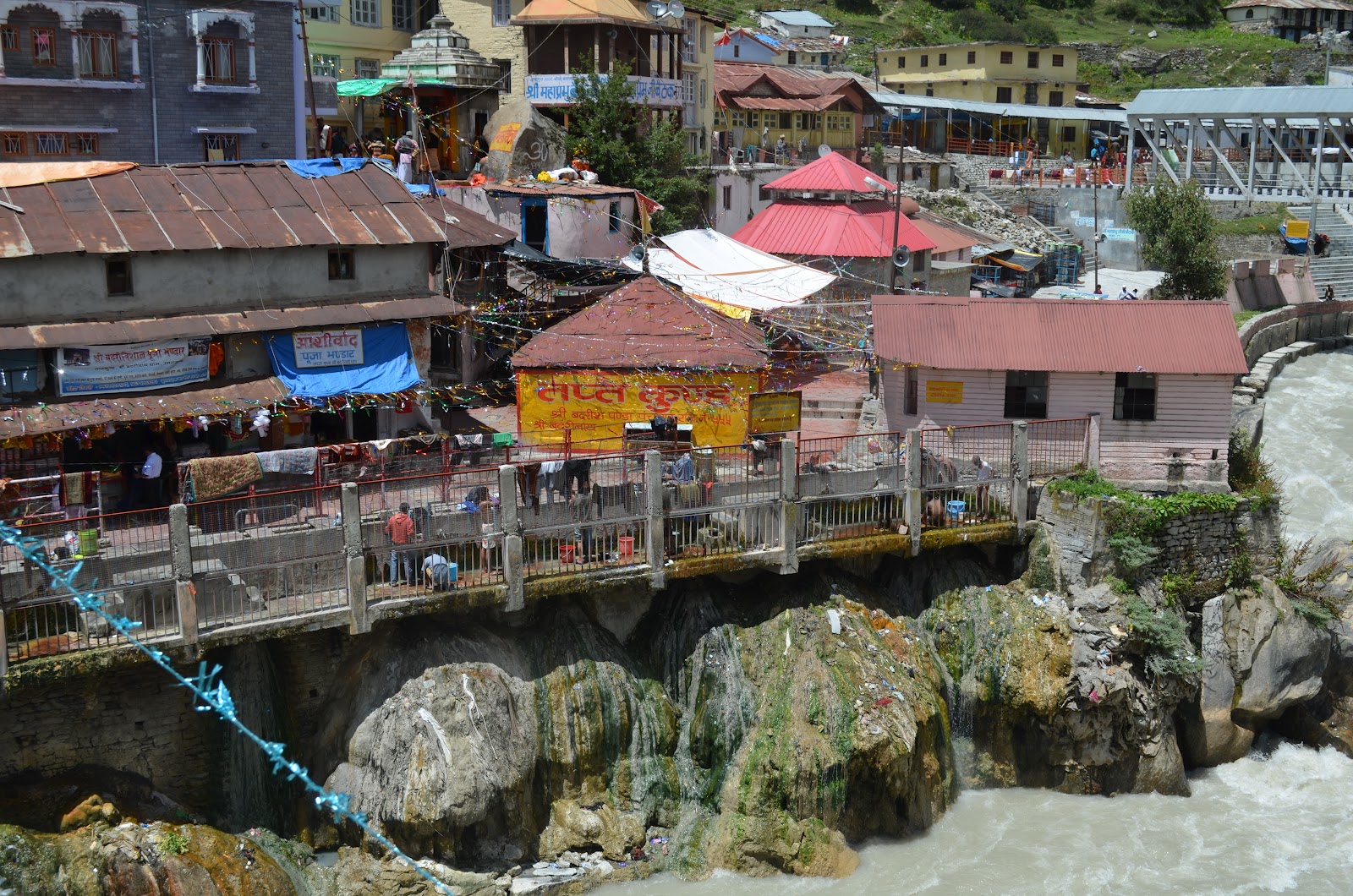
The second part of the Journey began from Haridwar and ended at Govindghat which is the base for the 14 km trek to Valley of Flowers (VOF) and Hemkund Sahib (HS). The town has a gurudwara (Temple) offering services to Sikhs making the pilgrimage - you can hire porters and mules to help you on the trek as well. We crossed the river to start the trek on a beautiful path which was nothing more than cobbled stones and mule dung with most of the mud washed away by rain. The below pictures show Govindghat town with the river and the trek path.

 5 Kms into the trek, yours truly was absolutely tired and hence we hired ponies to take us up. Hence, while the 5 km walk took us 3 hours, the next 9 kms took exactly the same time. But the path was beautiful and we resolved that we would walk back. We reached Ghangaria at 4 PM in the evening and set out to explore the town which was about a 100m of small hotels, eateries and the Sikh temple. The place didnt have electricity connection till last year thanks to the remoteness of the site. The accommodation was not great shakes too - it had a bed and thick woollen sheets to keep you warm. Given the season, it was brimming with Sikhs/Sardars from all corners of the world (we met Sikhs of all ages from Mumbai, Punjab, Delhi, Haridwar and even London). The below pictures are of Ghangaria town :


 This is the last point of the valley. Beyond this, it is rolling plains of meadows leading to the glacier where Puspavati river originates. Incidentally, Puspavati means "Lady of the flowers". What needs to be noted that while Badrinath town at an altitude of 10000 feet has no greenery to boast about, VOF at an altitude of 15000 feet is totally green despite being snow covered for 8 months !


The second part of the Journey began from Haridwar and ended at Govindghat which is the base for the 14 km trek to Valley of Flowers (VOF) and Hemkund Sahib (HS). The town has a gurudwara (Temple) offering services to Sikhs making the pilgrimage - you can hire porters and mules to help you on the trek as well. We crossed the river to start the trek on a beautiful path which was nothing more than cobbled stones and mule dung with most of the mud washed away by rain. The below pictures show Govindghat town with the river and the trek path.


Pushpavati river just before Ghangaria town

The town of Ghangaria - A small town nestled in the valley

Beautiful mountains around the town
Day 3:
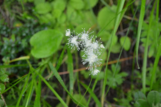
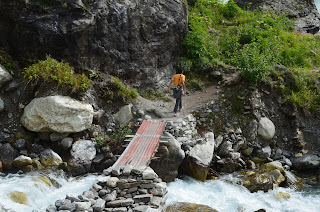
Few tips while going to the valley. Choose a clear day if you can. Leave early to beat the crowd and catch the flowers fresh. Finally, carry loads of water & food for the way as the valley offers nothing since all commercial activity is banned due to ecological reasons. You need to walk all the way (5 kms to the valley and another 5-6 kms in the valley) as the mules are not allowed to enter the valley too. The area is such a pristine hotspot that a few meters into the path, you start to see the flowers blooming. The walk takes you across streams, tall trees, valleys, high & lows but the entire path is packed with flowers of various kinds, colours and shapes. The going was slow as we would stop every few minutes to hunt for new flowers and admire the abundance of nature's beauty. Some of the pictures below show the path and the flowers leading upto the valley (all photos are till the valley and not of the valley itself) -


The valley itself takes you to a different zone, walking to a valley full of flowers with not a single soul around at an altitude of around 15000 feet is an experience. An experience which cannot be captured by photographs or words. It needs to be felt. We were tired but we wanted to walk all the way in the valley. We ran out of water so we caught the water from the streams in the valley (there are TONS of them). We had no food but we decided to move on and we didn't regret it at all. I will now let the pictures talk -


As we started our walk back, we came across this beautiful flower (looking like a sunflower) shying away from us partially. Could not resist posting this picture.

Some thoughts about the entire journey -
- The entire place is free of plastic or any man made things. People are requested to take their garbage back. People being people do litter the place however, there are wardens who clean the garbage and try their best to keep the place clean.
- Despite asking people not to pluck flowers, they do. Cant do much can we?
- The valley is beautiful as long as you are alone. However, as the day progresses, more people come in and the valley becomes a rush of people trampling flowers to get photos etc. Leaves a sad taste in your mouth.
I sincerely hope this valley remains truly inaccessible to people as it is a truly wonderful site (one of a kind in the world). Opening it up more to people is likely to harm this place. Considering that it is a 100 Sq. Kilometer valley with 600+ varieties of flowers blooming (some of them unique to the valley), we need to preserve it.
Finally, how many flowers did we capture? I guess 30-40. But it was worth every petal of it. Hemkund Sahib, here we come.